
Complete
Project Objectives
Determine what species of marine mammals and sea turtles are present and estimate abundance.
Complete
Project Objectives
The goal of the visual surveys is to collect individually-identifying information from humpback whales present near and around Farallon de Medinilla (FDM)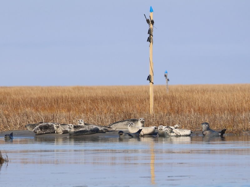
Winter is here in Virginia, and so are the seals!
January 21, 2025
NAVFAC LANT researchers are back at it for the 11th field season of monitoring gray and harbor seals at two major haul-out locations in southeastern Virginia.
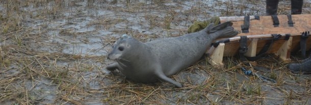
Seal Tagging Team Win!
February 6, 2018
Successful seal tag deployment on the Eastern Shore of VA.
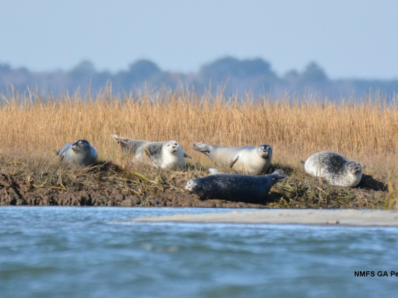
First Harbor Seal Haul-Out Survey of the Season in Virginia
December 19, 2017
Seals have arrived in Virginia
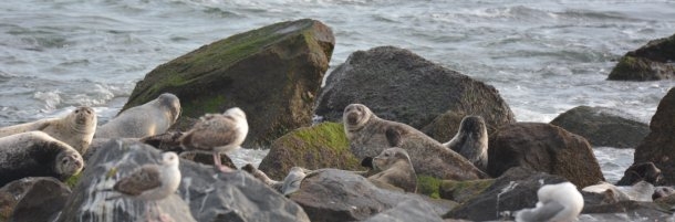
Seals of Rhode Island and Virginia
February 17, 2016
Two projects studying harbor seals on the east coast.
Are you my mother? A test of matrilineal social organization in mass strandings and living groups of rough-toothed dolphins.
20th Biennial Conference on the Biology of Marine Mammals .
More details
Collapse details
Date Published:
Filesize:
- December 9, 2013
Rough-toothed dolphins (Steno bredanensis) are reported to form isolated communities with stable groups around some oceanic islands. Within these communities, this species exhibits cooperative foraging and care-giving behavior including the sharing of large prey. These group behaviors could be driving community level structure where there are clear differences in habitat use between island groups, and limited movement among islands. Similar social characteristics are found in other cetacean species, e.g. killer whales, where individuals remain in maternally related groups indefinitely, forming “extended matrilines” as reflected by a single mitochondrial (mt) DNA haplotype. Here we test the hypothesis that rough-toothed dolphins also form “extended matrilines” using mtDNA control region haplotypes as a marker for maternal lineages. Alternatively, we test the influence of maternal fidelity on group structure within communities. The sample collection comprises adults from Pacific Ocean Islands and the continental Atlantic USA spanning 1976-2010. We sequenced mtDNA from 4 deceased groups (3 mass strandings and 1 bycatch; 350bp; n=28 teeth samples) and 14 living groups (460bp; n=106 skin samples) identifying 22 haplotypes. Differentiation and haplotype diversity were evaluated for groups within island communities in the Hawaiian Islands (Kauai and Hawaii) and Society Islands (Moorea and Raiatea) as well as between islands communities. Our results revealed multiple matrilines in 16 of the 18 groups, allowing us to reject the hypothesis of strict matrilineal structure. Although an AMOVA detected significant differentiation between island communities, groups did not significantly partition any genetic diversity within island communities. This is consistent with permutation tests where no strong signal of matrilineal influence was identified within island communities. Our study provides evidence of genetic structure at the community level, but demonstrates negligible structure at the group level. Fine-scale analyses to evaluate kinship and temporal association patterns are underway to further our understanding of group structure for this species.
- 3,807.46 KB
More details
Collapse details
Date Published:
Filesize:
- April 1, 2024
This report describes results from vessel surveys and visual species-verification trials conducted at the Jacksonville Shallow Water Training Range (JSWTR) in the Jacksonville Operating Area (OPAREA). This work continues from a multi-institutional monitoring program intended to provide information on the species composition, population identity, density, and baseline behavior of marine mammals and sea turtles present in United States (U.S.) Navy range complexes along the U.S. Atlantic Coast.
- 17,443.07 KB
More details
Collapse details
Date Published:
Filesize:
- July 11, 2011
Ecological acoustic recorders (EARs) have been deployed around the islands of Oahu and Kauai in a project sponsored by the Office of Naval Research. Detailed information on the EAR was published by Lammers et al. (2008). EARs have been deployed from February, 2009 to the present time around Oahu and from February, 2009 until April, 2011 around Kauai. From April, 2011 four EARs in the waters of Kauai have been deployed along the southern coast.
- 1,372.43 KB
More details
Collapse details
Date Published:
Filesize:
- November 1, 2018
In August 2017, a marine mammal monitoring project was carried out combining boat-based field efforts and passive acoustic monitoring on and around the Pacific Missile Range Facility (PMRF). Commander, Pacific Fleet (PACFLT) funded five days of small-boat effort and the National Marine Fisheries Service funded an additional six days of effort. Information obtained was compared to previous sightings during small-boat effort by Cascadia Research Collective (CRC) off Kauai and Niihau, during 1,119 hr of effort (19,194 km) over nine different years from 2003 through 2016 (see Baird 2016)
- 2,093.16 KB
More details
Collapse details
Date Published:
Filesize:
- November 30, 2023
As part of the long-term United States (U.S.) Navy-funded Marine Species Monitoring Program, from 5-13 August 2023, Cascadia Research Collective (CRC) carried out a vessel-based field effort in conjunction with passive acoustic monitoring undertaken by U.S. Navy (Navy) scientists on and around the underwater hydrophone ranges of the Pacific Missile Range Facility (PMRF).
- 2,846.35 KB
More details
Collapse details
Date Published:
Filesize:
- May 1, 2024
As part of the long-term United States (U.S.) Navy-funded Marine Species Monitoring Program, from 11–19 February 2024, Cascadia Research Collective (CRC) carried out a vessel-based field effort in conjunction with passive acoustic monitoring undertaken by the U.S. Navy (Navy) scientists on and around the underwater hydrophone ranges of the Pacific Missile Range Facility (PMRF). The effort was timed to occur immediately prior to the start of a Submarine Command Course (SCC) to allow for collection of movement and dive data that could be used to examine exposure and response of cetaceans to Navy mid-frequency active sonar (MFAS; see Henderson et al. 2021). Eight days of field effort were funded by the Navy, and one day of field work was funded by National Oceanic and Atmospheric Administration (NOAA) Fisheries. Wildlife Computers SPLASH10-F satellite tags were funded by the Navy for deployment on Navypriority species, and additional tags were provided by Wildlife Computers or CRC for deployment on other species (e.g., humpback whales [Megaptera novaeangliae]). Tags were programmed to collect dive behavior and Fastloc®-Global Positioning System (GPS) data from the time deployed until three and a half days after the end of the SCC and continue to transmit the dive and Fastloc®-GPS data for an additional six days. Starting on either May 2nd or May 3rd, the tags were duty cycled to transmit only every second day, to provide longer-term tracks of individual movements. During the period that tags were collecting dive and Fastloc®-GPS data, tags were programmed to try to obtain Fastloc®-GPS locations only for the 12 hours of the day when there were no or limited satellite overpasses. This programming change from previous Kauaʻi field efforts was taken to minimize temporal gaps in location data during the period that overlapped with and immediately followed the SCC. Field efforts were undertaken out of Kikiaola small boat harbor when conditions allowed for working on or near PMRF, or out of Port Allen when conditions on or near PMRF were not workable.
- 4,707.83 KB
More details
Collapse details
Date Published:
Filesize:
- February 13, 2020
As part of the long-term United States (U.S.) Navy-funded Marine Species Monitoring Program, from 16–24 August 2022, Cascadia Research Collective (CRC) carried out a vessel-based field effort in conjunction with passive acoustic monitoring undertaken by U.S. Navy (Navy) scientists on and around the underwater hydrophone ranges of the Pacific Missile Range Facility (PMRF).
- 2,743.90 KB
More details
Collapse details
Date Published:
Filesize:
- February 1, 2011
Movements and Spatial Use of Satellite‐tagged Odontocetes in the Western Main Hawaiian Islands: Results of Fieldwork Undertaken off O‘ahu in October 2010 and Kaua‘i in February 2011
- 1,236.87 KB
More details
Collapse details
Date Published:
Filesize:
- June 7, 2012
Although considerable information is available on residency patterns and spatial use of odontocetes in the eastern half of the Hawai‘i Range Complex (HRC), much less is known about odontocetes in the western half of the HRC. In the second year of a three-year effort in the western main Hawaiian Islands we undertook surveys off Kaua‘i and Ni‘ihau in July/August 2011, to examine spatial use and residency patterns using satellite tags, to provide visual verification of acoustically-detected odontocetes on the Pacific Missile Range Facility (PMRF), and to obtain individual identification photographs and biopsy samples for assessment of population identity and structure.
- 3,048.07 KB
More details
Collapse details
Date Published:
Filesize:
- August 27, 2012
As part of an assessment of habitat use and movements of odontocetes being undertaken in the western half of the main Hawaiian Islands (see Baird et al. 2011, 2012), field operations funded by Commander, U.S. Navy Pacific Fleet were undertaken off of Kaua‘i in January 2012. There were two primary goals of these operations: 1) providing species verification for acoustic detections by the Marine Mammal Monitoring on Navy Ranges (M3R) project on the Pacific Missile Range Facility (PMRF) hydrophone range (see Moretti et al. 2012); and 2) deploying satellite tags prior to a Submarine Commanders Course (SCC) training event to be undertaken off Kaua‘i in February 2012.
- 2,519.53 KB
More details
Collapse details
Date Published:
Filesize:
- November 8, 2013
Here we combine results of field efforts funded through the U.S. Navy’s Living Marine Resources Program (through a three-year grant from the Naval Postgraduate School) as well as additional field time in the study area in 2011 and 2012 funded through the Pacific Islands Fisheries Science Center and Commander, Pacific Fleet. We also utilize results from research efforts in the eastern main Hawaiian Islands, off Lāna‘i, Maui, and Hawai‘i Island, to help interpret results from photo-identification and satellite tagging.
- 2,159.00 KB
More details
Collapse details
Date Published:
Filesize:
- May 30, 2014
The Pacific Missile Range Facility (PMRF) off the island of Kaua‘i is the site of regular United States (U.S.) Navy training, some of which involves mid-frequency active sonar (MFAS) use from different types of military sound sources. PMRF includes acoustic instrumentation which allows for passive acoustic monitoring (PAM) capabilities to detect and localize sounds such as vocalizing marine mammals. Recent boat-based studies at PMRF have utilized real-time PAM (in conjunction with the Marine Mammal Monitoring on Navy Ranges project) to detect odontocetes for vectoring a field tagging boat to groups in order to increase the likelihood of deploying satellite tags. The resulting data have allowed for an assessment of habitat use and range of several different species. Some of these boat-based tagging efforts were timed to occur just before Submarine Commanders Courses (SCCs) occurring on PMRF so that animal movements and diving behavior could be measured both before and during sonar use.
- 1,819.34 KB
More details
Collapse details
Date Published:
Filesize:
- June 1, 2017
The U.S. Navy’s marine species monitoring program addresses four general topics surrounding the impact of midfrequency active sonar (MFAS) on protected species: occurrence, exposure, response, and consequences. Occurrence of odontocete cetaceans on and around the Pacific Missile Range Facility (PMRF) has been studied for several years using a combination of satellite tags and photo-identification, demonstrating the existence of resident populations of several species of odontocetes and resulting in considerable information on diving behavior and movement patterns of these species.
- 5,755.31 KB
More details
Collapse details
Date Published:
Filesize:
- October 1, 2019
A number of species of resident and non-resident odontocetes use the waters of the Kaulakahi Channel between Kaua‘i and Ni‘ihau, overlapping with the Pacific Missile Range Facility (PMRF). Submarine Command Courses (SCCs) held at PMRF provide an opportunity to assess exposure and measure odontocete reactions to mid-frequency active sonar (MFAS) being used in realistic training scenarios. The primary goal of this assessment was to estimate MFAS received levels (RLs) for satellite tagged odontocetes and determine whether any large-scale movements occurred in response to hull-mounted surface ship MFAS exposure. Two prior reports have used odontocete satellite tag data and information on MFAS use to estimate RLs for animals tagged in 2011 through 2015.
- 2,845.77 KB
More details
Collapse details
Date Published:
Filesize:
- December 16, 2013
A joint project in February 2013 of the Pacific Missile Range Facility (PMRF) combined passive acoustic monitoring and boat-based field efforts. There were 1,010 kilometers (km) (55.9 hours [hr]) of small-vessel field effort over the course of the 8-day project. Of the 55.9 hr of survey effort, 64.2 percent was spent within the PMRF instrumented hydrophone range boundaries, and 14.8 percent of the effort was in depths greater than 1,000 meters (m).
- 2,028.91 KB
More details
Collapse details
Date Published:
Filesize:
- February 5, 2013
A joint project in July and August 2013 on and around the Pacific Missile Range Facility (PMRF) combined passive acoustic monitoring and boat-based field efforts. There were 671 kilometers (36.6 hours [hr]) of small-vessel survey effort over the course of the 8-day project, with 55.1 percent of time (20.2 hr) spent within the PMRF instrumented hydrophone range boundaries. A total of 33.0 hr of acoustic monitoring coincided with the small-vessel field effort.
- 2,118.63 KB
More details
Collapse details
Date Published:
Filesize:
- April 24, 2015
A joint project in February 2014 on and around the Pacific Missile Range Facility (PMRF) was carried out utilizing combined passive acoustic monitoring and boat-based field efforts. There were 1,287 kilometers (km) (66.3 hours [hr]) of small-vessel survey effort over the course of the 10 day project, with 44.6 percent of search time (29.6 hr) spent within the PMRF instrumented hydrophone range boundaries. A total of 81.7 hr of acoustic monitoring was undertaken during the field effort. There were 26 sightings of five species of odontocetes, six of which were directed by acoustic detections from the Marine Mammal Monitoring on Navy Ranges (M3R) system.
- 6,792.21 KB
More details
Collapse details
Date Published:
Filesize:
- May 2, 2016
A joint project in February 2015 on and around the Pacific Missile Range Facility (PMRF) was carried out utilizing combined boat-based field efforts and passive acoustic monitoring from the Marine Mammal Monitoring on Navy Ranges (M3R) system. There were 1,132 kilometers (63.4 hours [hr]) of small-vessel survey effort over the course of the 13-day project. Weather conditions precluded field operations on 4 days, and strong westerly winds and/or range operations limited access to PMRF on seven additional days, with only 15.1 percent of search time (9.6 hr) spent within the range boundaries.
- 2,992.69 KB
More details
Collapse details
Date Published:
Filesize:
- June 1, 2017
As part of a long-term U.S. Navy-funded marine mammal monitoring program, in February 2016 a combining boat-based field effort and passive acoustic monitoring was carried out on and around the Pacific Missile Range Facility (PMRF). The U.S. Navy funded five days of small-boat effort and the National Marine Fisheries Service funded an additional two days of effort. There were 859 kilometers (49 hours) of small-vessel survey effort over the course of the seven day project.
- 2,847.59 KB
More details
Collapse details
Date Published:
Filesize:
- July 24, 2018
As part of a long-term U.S. Navy-funded marine mammal monitoring program, in August 2017 a combination of boatbased field effort and passive acoustic monitoring was carried out on and around the Pacific Missile Range Facility (PMRF) off Kaua‘i prior to a Submarine Command Course scheduled for mid-August 2017. The U.S. Navy funded five days of small-boat effort and the National Marine Fisheries Service funded an additional six days of effort. There were 1,113 kilometers (77.4 hours) of small-vessel survey effort over the course of the 11 day project.
- 4,400.14 KB
More details
Collapse details
Date Published:
Filesize:
- June 7, 2019
As part of a long-term U.S. Navy-funded marine mammal monitoring program, in August 2018 a combination of vessel-based field effort and passive acoustic monitoring was carried out on and around the Pacific Missile Range Facility (PMRF) Kaua‘i prior to a Submarine Commander Course scheduled for mid-August 2018. The purpose of the monitoring effort was to assess the spatial movement patterns and habitat use of cetaceans that are exposed to mid-frequency active sonar and how those patterns influence exposure and potentially responses.
- 10,036.77 KB
More details
Collapse details
Date Published:
Filesize:
- February 1, 2021
As part of a long-term U.S. Navy-funded marine mammal monitoring program, in February 2020 a combination of vesselbased field effort and passive acoustic monitoring was carried out on and around the Pacific Missile Range Facility (PMRF) off Kaua‘i prior to a Submarine Command Course scheduled for mid-February 2020. The purpose of the monitoring effort was to assess the spatial movement patterns and habitat use of cetaceans that are exposed to midfrequency active sonar and how those patterns influence exposure and potentially responses. Results from this effort were compared with previous Cascadia Research Collective (CRC) survey effort and photo-identification and tag data from Kaua‘i, based on surveys in 11 different years since 2003.
- 4,010.56 KB
Habitat-based density estimates for cetaceans within the waters of the U.S. Exclusive Economic Zone around the Hawaiian Archipelago.
NOAA technical memorandum NMFS PIFSC. 2021.
110. https://doi.org/10.25923/x9q9-rd73
More details
Collapse details
Date Published:
Publication:Ocean:Region:Species:Methods:
- January 1, 2021
The Hawaiian Islands Cetacean and Ecosystem Assessment Survey (HICEAS) 2017 was conducted in waters within the United States (U.S.) Exclusive Economic Zone (EEZ) around the Hawaiian Archipelago (henceforth “Hawaiian EEZ” for brevity) from 6 July through 1 December 2017 (Yano et al. 2018). The primary objective of this line-transect survey was to collect cetacean sighting data to support the derivation of cetacean density estimates using both design-based analyses and habitat modeling techniques.
Line-transect Abundance Estimates of Cetaceans in U.S. Waters around the Hawaiian Islands in 2002, 2010, and 2017.
NOAA technical memorandum NMFS PIFSC. 2021.
115. https://doi.org/10.25923/daz4-kw84
More details
Collapse details
Date Published:
Publication:Ocean:Region:Species:
- January 1, 2021
The Hawaiian Islands Cetacean and Ecosystem Assessment Survey (HICEAS) is a recurring ship-based, line-transect survey designed to estimate cetacean abundance in the entirety of the Hawaiian EEZ.
- Blue whale
- Bryde's whale
- Humpback whale
- Minke whale
- Sei whale
- Blainville's beaked whale
- Bottlenose dolphin
- Goose-beaked whale
- False killer whale
- Fraser's dolphin
- Killer whale
- Longman’s beaked whale
- Melon-headed whale
- Pygmy killer whale
- Risso's dolphin
- Rough-toothed dolphin
- Short-finned pilot whale
- Sperm whale
- Spinner dolphin
- Spotted dolphin
- Striped dolphin
More details
Collapse details
Date Published:
Filesize:
- February 1, 2016
This report forms part of a multi-institutional monitoring project intended to provide information on the species composition, population identity, density and baseline behavior of marine mammals and sea turtles present in United States (U.S.) Navy range complexes along the U.S. Atlantic Coast
- 16,962.42 KB
More details
Collapse details
Date Published:
Filesize:
- August 1, 2017
This report forms part of a multi-institutional monitoring project intended to provide information on the species composition, population identity, density, and baseline behavior of marine mammals and sea turtles present in United States (U.S.) Navy range complexes along the U.S. Atlantic Coast.
- 6,962.02 KB
Aerial Surveys for Protected Marine Species in the Jacksonville OPAREA: 2017 Annual Progress Report.
More details
Collapse details
Date Published:
Filesize:
- April 1, 2018
This report represents one facet of a collaborative multi-institutional monitoring project intended to provide information on the species composition, population identity, density and baseline behavior of marine mammals and sea turtles present in United States (U.S.) Navy range complexes along the U.S. Atlantic Coast.
- 16,812.91 KB
More details
Collapse details
Date Published:
Filesize:
- April 20, 2015
HDR vessel-based visual monitoring for marine mammals was conducted 1–9 February 2014 in conjunction with Cascadia Research Collective (CRC) satellite-tagging and real time acoustic monitoring by the Marine Mammal Monitoring on Navy Ranges (M3R) team. These efforts were to aid species-validation projects conducted in and around the Pacific Missile Range Facility (PMRF) instrumented range, northwest of Kauai in the Hawaii Range Complex (HRC). The monitoring survey was conducted prior to the commencement of the U.S. Navy’s Submarine Commanders Course (SCC) that took place 17–21 February 2014, which included the use of mid-frequency active sonar.
- 5,095.91 KB
More details
Collapse details
Date Published:
Filesize:
- September 21, 2012
A marine mammal species verification and satellite tagging test was carried out as part of the Marine Mammal Monitoring on Navy Ranges (M3R) program in collaboration with the Cascadia Research Collective from 11 June to 02 August 2012 at the Pacific Missile Range Facility (PMRF). The primary objective of the test was to acoustically detect marine mammals at PMRF and vector observers to vocalizing animals. This allowed the team to: 1) Visually verify at-sea species acoustically detected on the PMRF undersea range 2) Deploy satellite tags on marine mammals prior to the Rim of the Pacific Exercise (RIMPAC) to monitor animals’ movement before, during and after navy training. 3) Photograph animals to create a photo-ID record for the Hawaii Range Complex 4) Collect biological samples (fecal/biopsy) 5) Document group composition and behavior
- 1,372.72 KB
More details
Collapse details
Date Published:
Filesize:
- October 1, 2010
In order to train with mid-frequency active sonar (MFAS), the United States (U.S.) Navy has obtained a permit from the National Marine Fisheries Service (NMFS) under the Marine Mammal Protection Act. The Hawaii Range Complex (HRC) Monitoring Plan, finalized in December 2008 for implementation in January 2009, was developed with NMFS to comply with the requirements under the permit. The monitoring plan and reporting will provide science-based answers to questions regarding whether or not marine mammals are exposed and reacting to Navy MFAS. The objectives of the monitoring plan are to address the following questions: Are marine mammals and sea turtles exposed to MFAS at regulatory thresholds of harm or harassment? If so, at what levels and how frequently are they exposed? 1. If marine mammals and sea turtles are exposed to MFAS in the HRC, do they redistribute geographically in the HRC as a result of repeated exposure? If so, how long does the redistribution last? 2. If marine mammals and sea turtles are exposed to MFAS, what are their behavioral responses? Are they different at various levels? 3. What are the behavioral responses of marine mammals and sea turtles that are exposed to various levels and distances from explosives? 4. Are the Navy’s suite of mitigation measures for MFAS and explosives (e.g., Protective Measures Assessment Protocol [PMAP], measures agreed to by the Navy through permitting and consultation) effective at avoiding harm or harassment of marine mammals and sea turtles?
- 770.91 KB
More details
Collapse details
Date Published:
Filesize:
- August 1, 2017
This report describes results of vessel surveys from a multi-institutional monitoring project intended to provide information on the species composition, population identity, density, and baseline behavior of marine mammals and sea turtles present in United States (U.S.) Navy range complexes along the U.S. Atlantic Coast.
- 9,204.20 KB
More details
Collapse details
Date Published:
Filesize:
- April 1, 2018
This report describes results of vessel surveys from a multi-institutional monitoring project intended to provide information on the species composition, population identity, density, and baseline behavior of marine mammals and sea turtles present in United States (U.S.) Navy range complexes along the U.S. Atlantic Coast.
- 1,453.74 KB
More details
Collapse details
Date Published:
Filesize:
- May 1, 2019
This report summarizes the aerial survey effort conducted at the JAX site from 2009 through 2017. The monitoring project was intended to provide information on the species composition, density, and spatial distribution of marine mammals and sea turtles present in Navy’s JAX operating area (OPAREA), with particular focus on the intended site of the USWTR. These aerial surveys extended over nine years and yielded a very detailed seasonal picture of the occurrence, distribution and abundance of marine mammals and sea turtles in the region. This work also provides an important baseline against which future changes in the marine mammal and sea turtle fauna can be assessed.
- 2,580.34 KB
More details
Collapse details
Date Published:
Filesize:
- June 1, 2011
This report presents the results of marine mammal monitoring for the Koa Kai 11‐1 training event, and represents the continued monitoring efforts under the U.S. Navy’s Marine Species Monitoring Program. The objectives of the vessel‐based monitoring effort for Koa Kai 11‐1 consisted of the following: Perform focal behavioral follows of marine mammals during the course of a training event involving ASW. Assess the occurrence, distribution, and behavior of target species (marine mammals and sea turtles) using a vessel‐based line transect survey within the HRC in waters within or adjacent to the area where ships were training. Locate individual false killer whales (Pseudorca crassidens), pygmy killer whales (Feresa attenuata), and short‐finned pilot whales (Globicephala macrorhynchus) tagged by Dr. Robin Baird with Cascadia Research. Investigate the occurrence, distribution, and behavior of target species (marine mammals and sea turtles) using vessel‐based line transect survey in waters within or adjacent to the area where Navy ships were training
- 2,377.86 KB
More details
Collapse details
Date Published:
Filesize:
- January 1, 2012
In order to support the U.S. Navy in meeting regulatory requirements for monitoring established under the Final Rules and to provide a mechanism to assist with coordination of program objectives under the ICMP, this survey was conducted to confirm the Marine Mammal Monitoring on Navy Ranges (M3R) acoustic detections and marine mammal satellite tagging was prior to a training event, the Submarine Commander’s Course exercise, which would be conducted in the same area during February 2012.This report presents the methods and preliminary results of a vessel-based visual and acoustic survey effort that was conducted in conjunction with a tagging and species-validation project
- 2,313.85 KB
More details
Collapse details
Date Published:
Filesize:
- October 1, 2010
The results of marine mammal monitoring reported here for RIMPAC 2010 represent the first monitoring effort under the U.S. Navy’s Marine Species Monitoring Program (Contract # N62470-10-D-3011) issued to engineering-environmental Management, Inc., an HDR company (HDR|e²M). The monitoring effort for RIMPAC 2010 consisted of the following: Vessel-based line transect surveys to assess the diversity, distribution, and behavior of target species (e.g., marine mammals and sea turtles) Installation of one shallow- and one deep-water passive acoustic monitors (PAMs) in waters off Ni'ihau.
- 846.17 KB
More details
Collapse details
Date Published:
Filesize:
- September 19, 2024
This report presents a geographic information system (GIS)-based overview of the sighting records obtained during marine species monitoring effort (a total of 12 U.S. Pacific Fleet-funded surveys) to date in the MIRC. Also included are incidental marine mammal and sea turtle sightings made since 1965 on non-dedicated surveys in the region.
- 14,571.64 KB
More details
Collapse details
Date Published:
Filesize:
- August 31, 2012
The overall objective of the ICMP is to assimilate relevant data collected across U.S. Navy range complexes in order to answer questions pertaining to the impact of MFAS and explosives on marine mammals and sea turtles.
- 11,672.29 KB
More details
Collapse details
Date Published:
Filesize:
- November 1, 2012
The first phase to integrate the historical sum of these U.S. Navy-sponsored visual survey efforts for marine species monitoring in the HRC was prepared by Uyeyama (2011). This report represents the second phase of that effort and presents an overview of monitoring survey effort to date in the HRC. Available data from visual surveys performed by both contractor-led efforts and U.S. Navy in-house surveys was compiled and processed in order to: 1. Create a geographic information system (GIS)-based summation of all survey tracks that can be easily visualized. 2. Construct a geo-referenced database of sightings that can be queried by species, observer platform, Beaufort Sea State (BSS), season, or other sighting/survey variables. 3. Conduct an enhanced analysis of sighting success with respect to survey platform, field protocol, and environmental conditions. 4. Inform and adjust data collection procedures on future surveys as needed to reflect lessons learned from sighting data compilation efforts presented here. 5. Provide information to enhance informed management of marine protected species in the HRC and support the adaptive management process that is part of the ICM
- 19,704.58 KB
- Hawaiian Monk Seal
- Green turtle
- Bryde's whale
- Humpback whale
- Minke whale
- Sei whale
- Blainville's beaked whale
- Bottlenose dolphin
- Goose-beaked whale
- Fraser's dolphin
- Killer whale
- Longman’s beaked whale
- Melon-headed whale
- Pantropical spotted dolphin
- Pygmy killer whale
- Risso's dolphin
- Rough-toothed dolphin
- Short-finned pilot whale
- Spinner dolphin
- Striped dolphin
More details
Collapse details
Date Published:
Filesize:
- August 1, 2024
This report summarizes the results of satellite-tagging efforts conducted before Submarine Command Course (SCC) training events in August 2021 and 2022, at the Pacific Missile Range Facility (PMRF) off the island of Kauaʻi. Researchers tagged 21 delphinids to observe their behavior before, during, and after the SCCs, to estimate received levels (RLs) of mid-frequency active sonar (MFAS).
- 5,346.69 KB
More details
Collapse details
Date Published:
Filesize:
- November 18, 2021
This report summarizes the development and application of substantially upgraded analytical methods to quantify the movement and diving behavior of satellite tagged odontocetes before, during, and after Submarine Command Course (SCC) training events at the Pacific Missile Range Facility (PMRF) off Kaua‘i, Hawai‘i, including their predicted exposure and potential response to mid-frequency active sonar (MFAS) during these events
- 2,915.87 KB
More details
Collapse details
Date Published:
Filesize:
- October 1, 2010
This report summarizes work conducted in FY2009-FY2010 with Navy support to characterize marine mammal sounds related to passive acoustic monitoring in the Hawaii Range Complex (HRC). Existing acoustic data from the Hawaii Range Complex area were analyzed to provide better descriptions of acoustic signals by species.
- 1,122.87 KB
More details
Collapse details
Date Published:
Filesize:
- January 1, 2018
Passive acoustic monitoring was conducted using High-frequency Acoustic Recording Packages (HARPs) deployed in waters offshore of Virginia, North Carolina, and Florida with support from the US Navy during 2016 - 2017. The HARPs recorded underwater sounds between 10 Hz and 100 kHz. Data analysis consisted of analyst scans of long-term spectral averages (LTSAs) and spectrograms, and automated computer algorithm detection when possible. Three frequency bands were analyzed for marine mammal vocalizations and anthropogenic sounds: (1) Lowfrequency, between 10-1000 Hz, (2) Mid-frequency, between 1,000-5,000 Hz, and (3) Highfrequency, between 1-100 kHz.
- 5,208.04 KB
- Blue whale
- Bryde's whale
- Fin whale
- Minke whale
- North Atlantic right whale
- Sei whale
- Atlantic white-sided dolphin
- Blainville's beaked whale
- Bottlenose dolphin
- Clymene dolphin
- Common dolphin
- Goose-beaked whale
- Dwarf sperm whale
- False killer whale
- Gervais' beaked whale
- Killer whale
- Northern bottlenose whale
- Risso's dolphin
- Rough-toothed dolphin
- Short-finned pilot whale
- Sowerby's beaked whale
- Sperm whale
- Spotted dolphin
- Striped dolphin
More details
Collapse details
Date Published:
Filesize:
- March 1, 2019
The PIFSC CRP has conducted research on cetaceans in the Mariana Archipelago since 2010. A cooperative effort with funding from U.S. Navy Pacific Fleet and PIFSC has included summer and winter small-boat surveys off the southernmost islands (Saipan, Tinian, Aguijan, Rota, and Guam), development of photo-ID catalogs, analysis of collected tissue samples and satellite telemetry tag data, and shipboard visual and PAM surveys in portions of the EEZ in 2010 and 2015. PIFSC has maintained long-term PAM on moored recorders off Saipan and Tinian (since 2010) and off Pagan (since 2015) as part of the Pacific Islands Passive Acoustic Network (PIPAN). The goal of these efforts is to collect the data necessary to conduct population assessments for cetaceans within the Mariana Archipelago, including the determination of their occurrence, population structure and abundance, movements, distribution, and habitat use.
- 6,884.39 KB
More details
Collapse details
Date Published:
Filesize:
- March 2, 2017
The Pacific Islands Fisheries Science Center’s (PIFSC) Cetacean Research Program (CRP) has been conducting visual surveys and long-term acoustic monitoring for cetaceans in the waters surrounding Guam and the Commonwealth of the Northern Mariana Islands (CNMI) as part of an ongoing effort to develop a record of cetacean occurrence in the region. Visual surveys have been conducted aboard small boats (7.6-12.2 m) since 2010 off the southernmost islands of the Mariana Archipelago (Guam, Rota, Saipan, Tinian, and Aguijan). These surveys include the collection of photographs for individual identification, tissue samples for genetic analysis of population structure, and the deployment of satellite tags for assessment of individual movements throughout the broader region
- 2,999.73 KB
More details
Collapse details
Date Published:
Filesize:
- January 1, 2013
e Pacific Islands Fisheries Science Center’s (PIFSC) Cetacean Research Program (CRP) conducted surveys for cetaceans in the waters surrounding Guam and the Commonwealth of the Northern Mariana Islands (CNMI) in an effort to further develop a record of cetacean occurrence in the region.1 This was the fourth year conducting cetacean surveys aboard small boats (7.6 – 12.2 m) around the southern Mariana Islands of Guam, Rota, Saipan, Tinian, and Aguijan (Fig. 1). This project was carried out in partnership with the Commander, U.S. Pacific Fleet by a team of four primary personnel (Table 1). The collected data are being used to reveal the occurrence and distribution, stock structure, and movements of cetaceans within the study area.
- 1,488.70 KB
Cetacean Research in the Marianas.
NMFS-PIFSC External Program Review of Protected Species Science .
More details
Collapse details
Date Published:
Filesize:
- April 16, 2026
Goals: Understand species occurrence and distribution. Determine the population structure and abundance of the those species. Study the movements and habitat use of individuals and populations. Methods: Small boat-based and ship-based surveys. Passive acoustic recordings (HARPs & towed array). Photo-ID, biopsy sampling, and satellite tagging.
- 5,971.92 KB
Acoustic observation of the reaction of rough-toothed dolphin (Steno bredanensis) to vocalizations, most likely from killer whales (Orcinus orca), off Kaua‘i.
Marine Mammal Science. 2019.
1-7
More details
Collapse details
Date Published:
Publication:Ocean:Region:Species:Methods:
- July 1, 2019
From 4 to 14 August 2017 researchers from Cascadia Research Collective undertook a field project off the western shore of Kaua‘i.2 This field exercise, like several others in recent years, was conducted in collaboration with engineers from the Marine Mammal Monitoring on Navy Ranges (M3R) program (Jarvis et al. 2014). The U.S. Navy’s Pacific Missile Range Facility (PMRF) has a large array of 219 bottom-mounted hydrophones located off the west side of Kaua‘i. This array of hydrophones allows for passive acoustic monitoring of marine mammals over an area of approximately 2,500 km2 . The M3R system at PMRF has the ability to automatically detect, classify and localize certain acoustically active animals and also allows trained operators to monitor the acoustic activity on each hydrophone individually via real-time spectrogram displays.
Biologically Important Areas II for cetaceans within U.S. and adjacent waters – Hawaiʻi Region.
Frontiers in Marine Science. 2023.
10:21
More details
Collapse details
Date Published:
Publication:Ocean:Region:Species:Methods:
- January 25, 2023
In this assessment we incorporated published and unpublished information to delineate and score Biologically Important Areas (BIAs) for cetaceans in the Hawaiʻi region following standardized criteria. Twenty-six cetacean species have been documented in Hawaiʻi. Eleven odontocete species have distinct small populations resident to one or more island areas: rough-toothed dolphins, pantropical spotted dolphins, common bottlenose dolphins, spinner dolphins, short-finned pilot whales, false killer whales, pygmy killer whales, melon-headed whales, Blainville’s beaked whales, Cuvier’s beaked whales, and dwarf sperm whales.
More details
Collapse details
Date Published:
Filesize:
- March 1, 2025
Vessel Surveys and Visual Species: Verification Trials at the Jacksonville Shallow Water Training Range
- 5,953.46 KB
Rough-toothed dolphin exposures to U.S. Navy mid-frequency active sonar at the Pacific Missile Range Facility, Hawai‘i.
Detection, Classification, Localization, and Density Estimation of Marine Mammals Workshop. June 3–7, 2024. Rotterdam, The Netherlands .
More details
Collapse details
Date Published:
- June 3, 2024
- 480.76 KB
More details
Collapse details
Date Published:
- January 10, 2016
More details
Collapse details
Date Published:
Filesize:
- September 1, 2015
This report forms part of a multi-institutional monitoring project intended to provide information on the species composition, population identity, density and baseline behavior of marine mammals and sea turtles present in United States (U.S.) Navy range complexes along the U.S. Atlantic Coast.
- 19,502.08 KB
Species diversity and abundance at a cetacean "hot spot" off Cape Hatteras, North Carolina, USA.
21st Biennial Conference on the Biology of Marine Mammals .
More details
Collapse details
Date Published:
Filesize:
- December 13, 2015
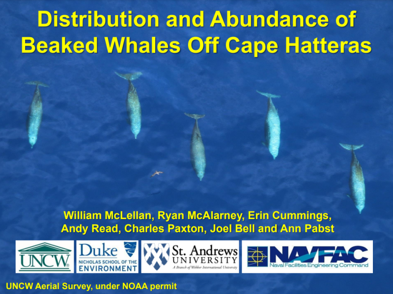
We have been conducting ongoing monthly aerial surveys off Cape Hatteras, NC, USA as part of the US Navy's marine species monitoring program in the Atlantic since 2011. We utilize line transect survey methods and extensively photograph all sightings to confirm species identification. Survey tracklines extend from shallow continental shelf waters, across the shelf break, to deep pelagic waters. From May 2011 through December 2014, 26,131km of trackline were flown, and 9,941 individual cetaceans were documented during 437 encounters. Nineteen species of cetaceans, including three mysticetes (Balaenoptera physalus, B. acutorostrata, Megaptera novaeangliae), five deep-divers (Physeter microcephalus, Kogia spp., Ziphius cavirostris, Mesoplodon europaeus, M. mirus), and eleven delphinids (Tursiops truncatus, Stenella frontalis, S. attenuate, S. coeruleoalba, S. clymene, S. longirostris, Steno bredanensis, Peponocephala electra, Lagenodelphis hosei, Grampus griseus and Globicephala macrorhynchus) were encountered. Similar surveys at the adjacent Onslow Bay, NC site yielded only 257 sightings (4,773 individuals representing nine species) despite nearly two times the survey effort flown (48,698km). At Cape Hatteras, minimum abundance estimates (i.e. uncorrected for availability or perception bias) were generated using spatio-temporal density surface modelling for species with sufficient detections. Predicted monthly abundance of T. truncatus varied between 170 (95% confidence interval; 0 - 17,100) and 3,450 (300 - 8,510). Monthly Stenella spp. abundance varied between 110 (0 - 360) and 1,720 (400 - 5,390). Monthly abundance of G. macrorhynchus varied between 10 (0 - 960) and 1,230 (220 - 4,300). These results demonstrate that the waters off Cape Hatteras support both higher diversity and density of cetaceans than adjacent waters along the US Atlantic coast. This site is included in the area of interest identified in six pending permits for large-scale, commercial seismic surveys. We suggest that the high density and diversity of cetaceans at this site warrants a special degree of concern by the US Bureau of Ocean Energy Management.
- 92.54 KB
More details
Collapse details
Date Published:
Filesize:
- March 22, 2004
Aerial surveys of marine mammals were performed as part of the Marine Mammal Monitoring on Navy Undersea Acoustic Ranges (3MR) program. Surveys were performed in three regions: a) Pacific Missile Range Facility (PMRF), Barking Sands, Kauai (BSURE and BARSTUR ranges; Jul 12-Nov 17, 2002); b) Bahamas (Northwest Providence Channel and AUTEC range; Jan 4-12, 2003); and c) main Hawaiian Islands (Feb 21–Apr 5, 2003). The mission was to identify species and record positions and composition of all marine mammal pods sighted. These data were made available to co-investigators (Martin and Moretti) of the 3MR program in order to correlate the visual positions with acoustic localizations using Navy assets. All surveys were flown in a twin-engine Partenavia aircraft at 100 knots airspeed and 244 m altitude. Four personnel participated on each flight including one observer on each side of the aircraft, data recorder and pilot. Methods used were consistent with those of modern distance sampling theory.
- 883.12 KB
More details
Collapse details
Date Published:
Filesize:
- September 10, 2007
Aerial surveys of marine mammal and turtle species were conducted during the period Aug. 13- 17, 2007 following completion of the “Valiant Shield” naval exercises in waters off the Northern Mariana Islands. Surveys encompassed approximately 2,352 km of linear effort, with transect grids distributed randomly throughout a 163,300 km2 target area.
- 2,743.09 KB
Pacific Missile Range Facility (PMRF) Species Verification and Satellite Tagging Test: January 2012.
More details
Collapse details
Date Published:
Filesize:
- January 1, 2012
During January 2012, with funding provided by the Chief of Naval Operations (CNO) N45 Energy and Environmental Readiness Division, the Marine Mammal Monitoring on Navy Ranges ( M3R) program supported a marine mammal species verification and satellite tagging test on the Pacific Missile Range Facility (PMRF) prior to a Submarine Commander Course (SCC)
- 1,778.01 KB
More details
Collapse details
Date Published:
Filesize:
- July 1, 2015
With funding from the Living Marine Resources (LMR) Program, the Marine Mammal Monitoring on Navy Ranges (M3R) passive acoustic monitoring system has been installed at the Pacific Missile Range Facility (PMRF). The overall goal of the program is to provide tools and methodologies for long-term monitoring of marine mammal populations. The program is laying the groundwork needed to adapt combined passive acoustic, tagging, and visual monitoring methods for animals and conditions at PMRF. For sonar-sensitive Blainville’s beaked whales (Mesoplodon densirostris; Md), the short- and long-term distribution, density, and habitat can be measured provided basic behavioral data such as group size and dive rates at PMRF are known.
- 2,873.86 KB
More details
Collapse details
Date Published:
Filesize:
- November 1, 2013
During 2007, the first large-scale survey for marine mammals and sea turtles -- the Mariana Islands Sea Turtle and Cetacean Survey (MISTCS) -- was conducted in the Navy’s Mariana Islands Range Complex (MIRC; DoN 2007, Fulling et al. 2011). The survey region encompassed approximately 584,800 square kilometers (km2) and was a rectangle bounded by 18° – 10° N and 142° –148° E. The survey used standard line-transect methodology and also included passive acoustic monitoring (PAM) using a towed hydrophone array system.
- 12,713.19 KB
More details
Collapse details
Date Published:
Filesize:
- March 22, 2022
The United States (US) Navy uses lookouts (LOs) to detect objects in the water in the vicinity of ships. One class of object that LOs are trained to detect is marine mammals ; this forms an important component of the Navy’s procedures for marine mammal mitigation during training activities . As well as dedications of marine mammals by these LOs, detections of marine mammals may also be made by other members of the ship’s crew such as officers on the bridge (“watchstanders”) or sonar technicians, although acoustic detections require visual confirmation. We refer to these personnel together as the “lookout team” (LT). The primary goal of this project was to determine how effective LTs are at detecting marin
- 4,078.84 KB
- California sea lion
- Green turtle
- Leatherback turtle
- Loggerhead turtle
- Kemp's Ridley turtle
- Blue whale
- Fin whale
- Humpback whale
- Minke whale
- Atlantic white-sided dolphin
- Common dolphin
- Harbor porpoise
- Killer whale
- Pantropical spotted dolphin
- Pilot whale
- Risso's dolphin
- Rough-toothed dolphin
- Short-finned pilot whale
- Sperm whale
- Spotted dolphin
- Striped dolphin
More details
Collapse details
Date Published:
Filesize:
- February 1, 2009
This report covers two separate activities carried out by the Cetacean Research Program at the Pacific Islands Fisheries Science Center from February to June 2009. A cetacean assessment survey of the main Hawaiian Islands was conducted by NMFS in February 2009. The survey was designed to conform to the 2002 NMFS HICEAS survey (Hawaiian Islands Cetacean Ecosystem Assessment Survey) so that abundance and distribution estimates would be comparable.
- 346.82 KB
More details
Collapse details
Date Published:
Filesize:
- November 1, 2016
The results of this study provide valuable information on the performance of two whistle classifiers for delphinid species in the northwestern Atlantic Ocean. Although the manual classifier requires more time and effort for the detection and extraction of whistles, it proved to be more generalizable to novel datasets than the automated classifier and also allowed identification of acoustic encounters that did not have associated visual observations (i.e., non-sighted encounters).
- 1,361.66 KB
More details
Collapse details
Date Published:
Filesize:
- May 1, 2017
This report describes the results of a study designed to explore some of the factors that may contribute to ambiguity in species identification using delphinid whistles. We have obtained field recordings of wild and trained (captive) odontocetes in their natural environment under a variety of scenarios, including at the sea surface, at multiple depths in the water column, in different geographic locations, and in different behavioral states
- 2,105.04 KB
The call of the wily: Using acoustics to identify delphinid species not visually confirmed in the waters around Guam and the Northern Mariana Islands.
Southern California Marine Mammal Workshop 2014 .
More details
Collapse details
Date Published:
Filesize:
- January 31, 2014
During a combined visual and acoustic cetacean abundance survey that took place in the waters around Guam and the Northern Mariana Islands, delphinid whistles were frequently detected, but were not always coupled with visual observations. As a resu lt, many acoustic detections were not identified to spec ies. Very little data exist on the occurrence and distribution of delphinids in this study area, so the ability to acoustically identify species that were not sighted can provide important information regard ing the occurrence and distribution of delphinid species in these waters.
- 1,513.42 KB
More details
Collapse details
Date Published:
Filesize:
- October 1, 2008
This document comprises the first annual progress report to the Department of the Navy on a monitoring program for protected marine species at the proposed site of an Undersea Warfare Training Range (USWTR) in Onslow Bay, North Carolina.
- 22,255.71 KB
More details
Collapse details
Date Published:
Filesize:
- March 20, 2012
This is the fourth progress report of a monitoring program for protected marine species in waters offshore Onslow Bay and Cape Hatteras, North Carolina and Jacksonville, Florida. The results of aerial surveys, vessel-based line transect and photo-ID surveys and passive acoustic monitoring are reported for the period from July 2010 through December 2011
- 54,560.00 KB
More details
Collapse details
Date Published:
Filesize:
- February 28, 2011
The February 2011 cruise to Ka‘ula was comprised two components: a dedicated seabird survey at the island of Ka‘ula to satisfy Sikes Act monitoring requirements and a marine mammal visual survey and tagging effort at the island of Kaua‘i and during the transit to Ka‘ula in order to satisfy Commander, Pacific Fleet’s marine mammal and sea turtle monitoring requirements. Relatively little research and monitoring has occurred at Ka‘ula
- 2,807.51 KB
Diel and lunar variation in diving behavior of rough-toothed dolphins (Steno bredanensis) off Kauaʻi, Hawaiʻi.
Marine Mammal Science. 2021.
37:4:1261-1276
More details
Collapse details
Date Published:
Publication:Ocean:Region:Species:Methods:
- October 1, 2021
Observational studies describe rough-toothed dolphins (Steno bredanensis) actively foraging during the day on epipelagic species. Using data from depth-transmitting satellite tags deployed on nine individuals off Kauaʻi, we investigated diving behavior and the effects of lunar phase and solar light levels on vertical movements.
More details
Collapse details
Date Published:
Filesize:
- October 1, 2010
The goal of the aerial survey was “to monitor and report the presence/absence, distribution/re-distribution, reaction/no reaction, injury, and/or mortality of MM/ST during exposure to SCC OPS Navy training event”. This involved monitoring and reporting, in as detailed fashion as possible, the surface behavior of MM/ST. In particular, we were to monitor for any changes in the near-surface behavior, orientation, occurrence, and location of animals relative to the USS Lake Erie’s activities using a systematic search and focal follow method. This included monitoring for any potentially dead, injured, or distressed animals and “any animals found to be exhibiting behaviors or associations deemed unusual”
- 499.86 KB
More details
Collapse details
Date Published:
Filesize:
- October 1, 2010
The monitoring plan and reporting will provide science-based answers to questions regarding whether or not marine mammals are exposed and reacting to Navy MFAS. The objectives of the monitoring plan are to answer the following questions: 1. Are marine mammals and sea turtles exposed to MFAS at regulatory thresholds of harm or harassment? If so, at what levels and how frequently are they exposed? 2. If marine mammals and sea turtles are exposed to MFAS in the HRC, do they redistribute geographically in the HRC as a result of repeated exposure? If so, how long does the redistribution last? 3. If marine mammals and sea turtles are exposed to MFAS, what are their behavioral responses? Are they different at various levels? 4. What are the behavioral responses of marine mammals and sea turtles that are exposed to various levels and distances from explosives? 5. Are the Navy’s suite of mitigation measures for MFAS and explosives (e.g., Protective Measures Assessment Protocol [PMAP], measures agreed to by the Navy through permitting and consultation) effective at avoiding harm or harassment of marine mammals and sea turtles?
- 1,280.19 KB
More details
Collapse details
Date Published:
Filesize:
- August 12, 2011
In order to train with mid‐frequency active sonar (MFAS), the Navy has obtained a Letter of Authorization (permit) from the National Marine Fisheries Service (NMFS) under the Marine Mammal Protection Act and a Biological Opinion under the Endangered Species Act. The Hawaii Range Complex (HRC) Monitoring Plan, finalized in December 2008 for implementation in January 2009, and amended in 2010, was developed with NMFS to comply with the requirements under the permit. The monitoring plan and reporting will provide science‐based answers to questions regarding whether or not marine mammals are exposed and reacting to Navy MFAS
- 2,229.63 KB
More details
Collapse details
Date Published:
Filesize:
- January 1, 2020
Long-term high-frequency acoustic recording packages (HARPs) at eight sites along the western North Atlantic shelf break.
- 1,430.35 KB
- Blue whale
- Fin whale
- Humpback whale
- North Atlantic right whale
- Sei whale
- Atlantic white-sided dolphin
- Blainville's beaked whale
- Bottlenose dolphin
- Common dolphin
- Goose-beaked whale
- False killer whale
- Gervais' beaked whale
- Killer whale
- Northern bottlenose whale
- Pilot whale
- Rough-toothed dolphin
- Short-finned pilot whale
- Sowerby's beaked whale
- Sperm whale
- Spotted dolphin
- Striped dolphin
- True's beaked whale
More details
Collapse details
Date Published:
Filesize:
- May 1, 2016
In accordance with the Hawaii Range Complex (HRC) Monitoring Plan, data were collected during 17-18 February 2015 during a Submarine Commanders Course (SCC) training event. The goals of the monitoring and this study were to: (1) collect data to assess the effectiveness of the Navy Lookout team; and (2) obtain data to characterize the possible exposure of marine species to mid-frequency active sonar (MFAS).
- 1,166.62 KB
Rough-toothed dolphins on a Navy range in Hawai'i: using LIMPET satellite-tag data to assess movements, habitat use, and overlap with Navy activities.
21st Biennial Conference on the Biology of Marine Mammals .
More details
Collapse details
Date Published:
Filesize:
- December 13, 2015
Much of the U.S. Navy's training activities in Hawai'i occur on the Pacific Missile Range Facility (PMRF), an area between the islands of Kaua'i and Ni'ihau. Surveys show that rough-toothed dolphins are the most frequently encountered and likely most abundant odontocete found on PMRF. Long-term photo-identification data indicate that individuals show considerable fidelity to Kaua'i and Ni'ihau, and genetic studies indicate they are demographically isolated from rough-toothed dolphins off Hawai'i Island.
- 91.93 KB
More details
Collapse details
Date Published:
Filesize:
- November 11, 2024
This review examines historical data from 535 odontocete stranding events in the Mariana archipelago and Hawaiian Islands by date, location and species and spans the time period of 1848 to 2023. Reports of strandings increased across the two geographic regions that were generally consistent over time. A total of 54 historical stranding events that represent 14 odontocete species are described for the Mariana Islands. A total of 481 stranding events that represent 19 odontocete species are described from the Hawaiian Islands, significantly updating the last published report that examined 202 odontocete strandings that occurred in the main Hawaiian Islands between 1937 and 2002. ArcGIS cluster maps were utilized to identify groupings of stranding events across the geographic regions. The majority of strandings in the Mariana Islands were reported from the west and southeastern coast of Guam, followed by Saipan, Rota and Tinian. Stranding hotspots in the Hawaiian Islands were identified at Mā’alaea Bay, Maui, at windward Oʻahu and near Kailua-Kona on Hawaiʻi Island.
- 493.28 KB
More details
Collapse details
Date Published:
Filesize:
- September 16, 2024
The University of Hawaii Health and Stranding Lab located at Marine Corps Base Hawaii (MCBH) is the only entity in the Pacific Islands region that responds to strandings, conducts necropsy and cause of death investigations, archives tissues and performs research to identify and evaluate threats to Pacific Island cetaceans. This project focuses on increasing our understanding of infectious diseases in the Pacific Island region by investigating the emerging diseases caused by circovirus, morbillivirus, herpesvirus and toxoplasmosis infections in cetaceans.
- 514.82 KB
More details
Collapse details
Date Published:
Filesize:
- September 9, 2024
We report significant pathological findings from 250 stranding investigations of 20 cetacean species in the Pacific Islands region between 2006 and 2022. Full or partial necropsies of 196 of the 250 stranding cases (78.4%) resulted in a diagnosis or multiple diagnoses associated with death in 126 cases. Natural disease accounted for 60.3% of stranded animals; approximately half were in poor body condition at time of death due to chronic illness. Morbillivirus and Brucella sp. infections caused mortality in eleven species, including striped dolphins and the Longman’s beaked whale. Toxoplasma infection, of anthropogenic cause in Hawaiʻi, led to the deaths of two spinner dolphins. Pygmy and dwarf sperm whales, beaked whales and pilot whales showed heavy parasitism by nematodes, cestodes and trematodes. Approximately 12.7% of stranded individuals were perinates/neonates, with three cases of dystocia with maternal mortality. Anthropogenic trauma was observed in 30.2% of strandings. In seven Cuvier’s beaked whales, cranial and/or microvascular hemorrhages were categorized as trauma. Vertebral and skull fractures were attributed to direct vessel strikes for two pygmy sperm whales, a Cuvier’s beaked whale, a humpback whale calf and a striped dolphin. Blast trauma was observed in three Fraser’s dolphins that were part of an uncommon stranding event. Significant plastic debris, and/or fishery debris were found in stomachs of six species and fatal fishhook penetration occurred in a Submitted in Support of the U.S. Navy’s 2023 Annual Marine Species Monitoring Report for the Pacific STANDARD FORM 298 Back (Rev. 8/98) bottlenose dolphin. This study highlights the value of carcass examinations in a region inhabited by small island associated populations where carcass recovery rates are low, and cetaceans face an array of natural and anthropogenic threats.
- 1,496.52 KB
- Humpback whale
- Blainville's beaked whale
- Bottlenose dolphin
- Goose-beaked whale
- Dwarf sperm whale
- False killer whale
- Fraser's dolphin
- Killer whale
- Longman’s beaked whale
- Melon-headed whale
- Pilot whale
- Pygmy killer whale
- Risso's dolphin
- Rough-toothed dolphin
- Short-finned pilot whale
- Sperm whale
- Spinner dolphin
- Spotted dolphin
- Striped dolphin
Inter and intra specific variation in echolocation signals among odontocete species in Hawaii, the northwest Atlantic and the temperate Pacific.
Journal of the Acoustical Society of America. 2016.
139 (4, Part 2):2061
More details
Collapse details
Date Published:
Publication:Ocean:Region:Species:Methods:
- April 1, 2016
Odontocete species use echolocation signals (clicks) to forage and navigate. The aim of this study is to explore inter- and intra-specific variation in clicks among odontocete species in the Northwest Atlantic, Temperate Pacific, and Hawaii. Clicks were examined for seven species of delphinids in the Northwest Atlantic; common dolphin, Risso’s dolphin, pilot whale, rough-toothed dolphin, striped dolphin, Atlantic spotted dolphin, and bottlenose dolphin. Newly developed PAMGuard tools were used to automatically measure a suite of click parameters. Five parameters were compared among species; duration, center frequency, peak frequency, sweep rate, and number of zero crossings. Significant differences in duration, center and peak frequency were evident among species within this study area (Dunn’s test with Bonferroni adjustment p
More details
Collapse details
Date Published:
Filesize:
- August 1, 2018
The primary goals of HICEAS 2017 were to collect data required to estimate the abundance and distribution, examine the population structure, and understand the habitat of cetaceans within U.S. waters around the Hawaiian Islands. There were 5 major research components to HICEAS 2017: visual observations for cetaceans following a line-transect survey design; passive acoustic monitoring for cetaceans using towed hydrophone arrays, sonobuoys, and autonomous drifting acoustic recorders; collection of photographs and tissue samples and deployment of satellite tags for select cetacean groups; visual observations for seabirds following a strip-transect survey design; and ecosystem measurements for assessment of cetacean and seabird habitat.
- 15,414.29 KB
More details
Collapse details
Date Published:
Filesize:
- March 1, 2020
The primary goals of Winter HICEAS 2020 were to collect data required to estimate the abundance and distribution, examine the population structure, and understand the habitat of cetaceans around the main Hawaiian Islands during the winter months (January–March). There were 5 major research components to the project: visual observations for cetaceans following a line-transect survey design; passive acoustic monitoring for cetaceans using towed hydrophone arrays, sonobuoys, and autonomous drifting acoustic recorders; collection of photographs and tissue samples and deployment of satellite tags for select cetacean groups; visual observations for seabirds following a strip-transect survey design; and ecosystem measurements for assessment of cetacean and seabird habitat.
- 8,521.54 KB